We excel in developing custom software solutions to maximize the value of your data and website. Our background in the avalanche industry gives us a unique insight while providing custom solutions for your ideas.
Consulting & Custom Software Solutions
Applying science and technology to real world problems
Tailoring smart solutions
Think of us as part of your team
Our Solutions Include
- Scalable API development
- Relational & NoSQL database design
- Cloud computing
- Interactive web components and applications
- Web based GIS and mapping
- Weather data management
- Data exploration and analysis
Past Project Highlights
Serving Over 1 Million Users Per Week!
The National Avalanche Center (NAC) wanted to build a revolutionary new product for sharing and displaying the daily avalanche forecast danger for all US based avalanche centers. Snowbound Solutions built a robust and scalable API that powers the shared platform, collecting and visualizing daily avalanche forecast ratings for the entire US. On the front page of each avalanche center website is the National Danger Map and is the first thing most backcountry users see when looking for the avalanche forecast.
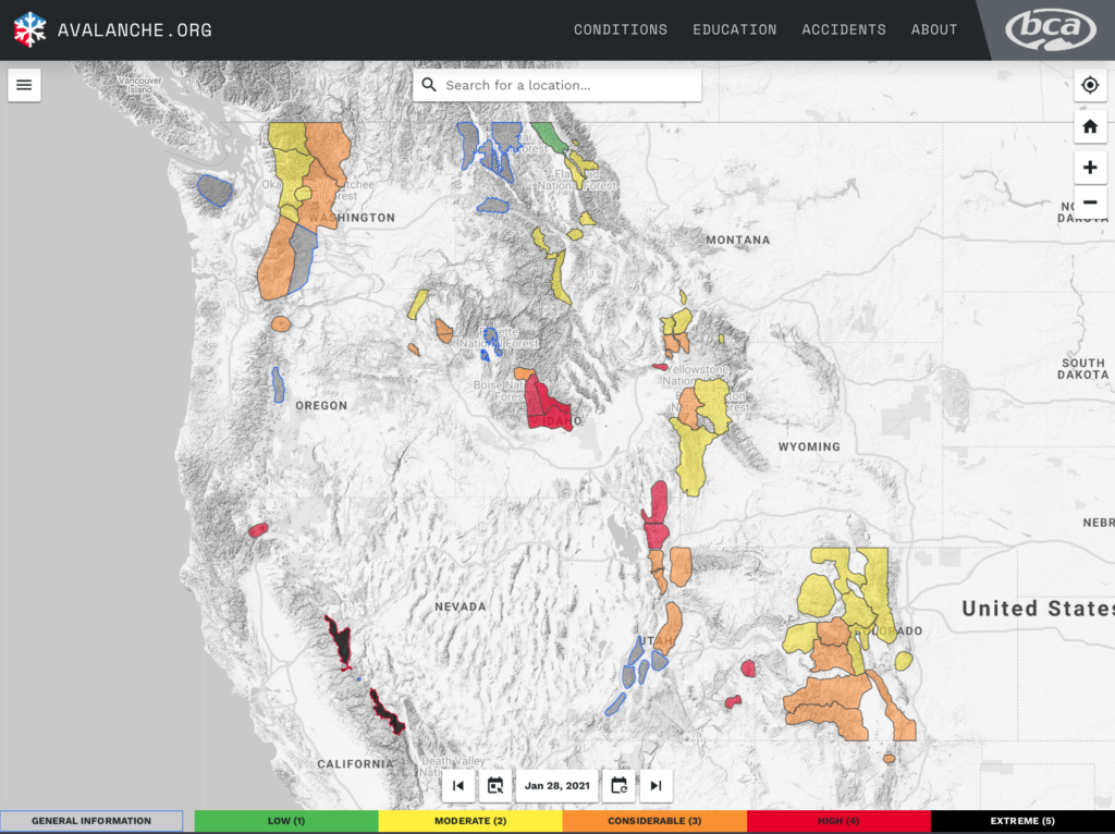
Providing data for Avalanche Forecast API
USED BY 13 AVALANCHE CENTERS
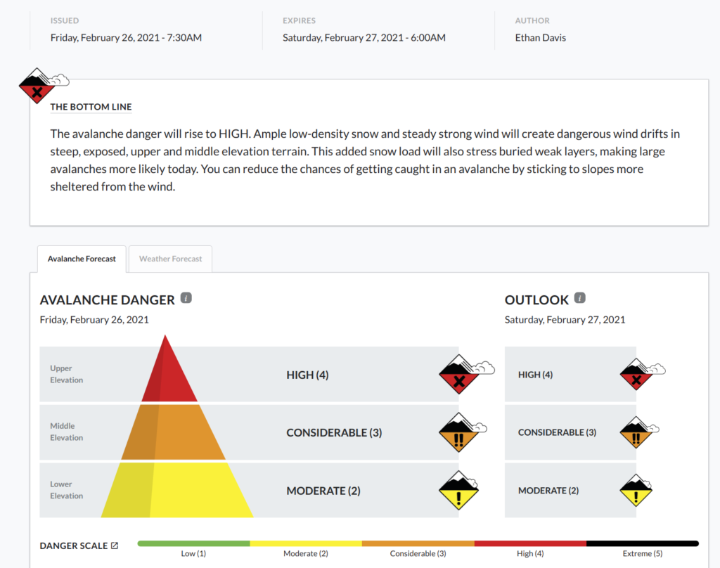
In 2019, the National Avalanche Center (NAC) desired to standardize the creation and visualization of an avalanche center forecast, a mission critical product. As a critical piece of an avalanche center’s mission, the platform had to be robust and not fail if traffic spiked unexpectedly. Therefore, Snowbound Solutions designed and built a reliable and scalable API to serve the avalanche forecast platform. An avalanche center creates and submits a forecast in their dashboard which is immediately available on the avalanche center website. Currently, the avalanche forecast platform serves 13 avalanche centers in the US.
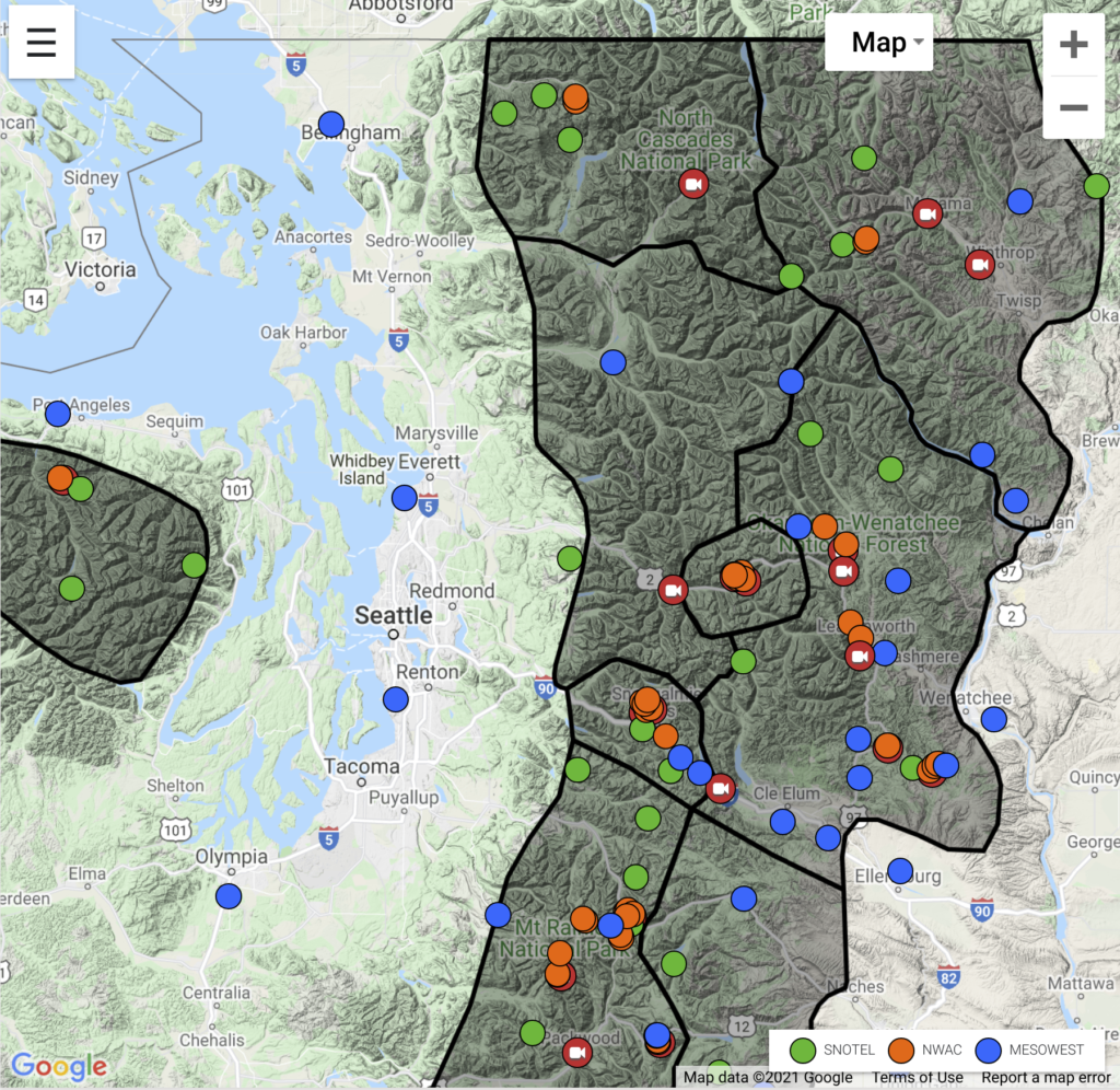
Weather maps used to monitor mountain weather API
USED BY 8 AVALANCHE CENTERS
Current mountain weather conditions are a critical piece of information for building avalanche forecasts or assessing avalanche hazard. The weather maps were initially built for the National Avalanche Center in 2015 and brought a common weather platform to US avalanche centers. Now in its third version, the weather maps allow for a user to quickly visualize the current weather conditions and analyze historic weather for specific areas. Currently, the weather maps serve 8 avalanche centers in the US.
Interested in Learning More?
Find out how Snowbound Solutions can help your natural hazard operation be more effective and efficient with our custom technology solutions and consulting services.